


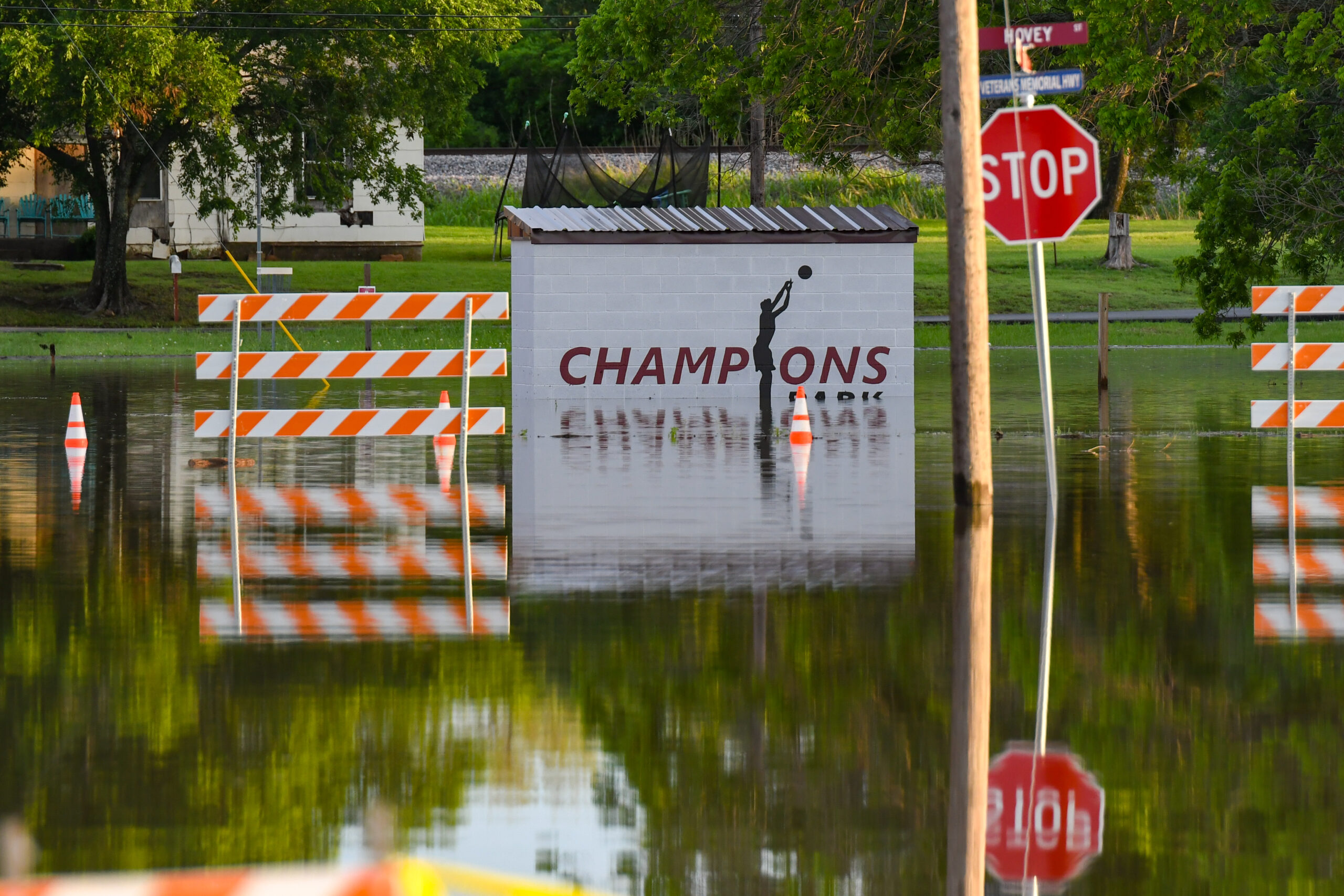
Sustained rainfall April 30 to May 6 led to flooding in low lying areas of Wise County, including the park near Hovey Street pictured above in Bridgeport. Wise County Office of Emergency Management is leading an effort to install sensors along several roads and water crossings to better measure flood impacts, potential road closures and the rate of water level increase. BRENDAN MARCHAND | WCMESSENGER
As Texas reels from one of the deadliest floods in its history, Wise County officials are turning to technology to better respond to flooding and its fallout.
The county recently launched the first phase of a flood monitoring system aimed at giving officials immediate access to water level and road condition data.
High-tech sensors installed at low-water crossings throughout the county are already helping the Wise County Office of Emergency Management track conditions in real time.
“These monitors allow us to remotely detect rising water levels, giving us the ability to respond quickly and close roads before they’re underwater,” said Precinct 4 Commissioner Colby Shawn.
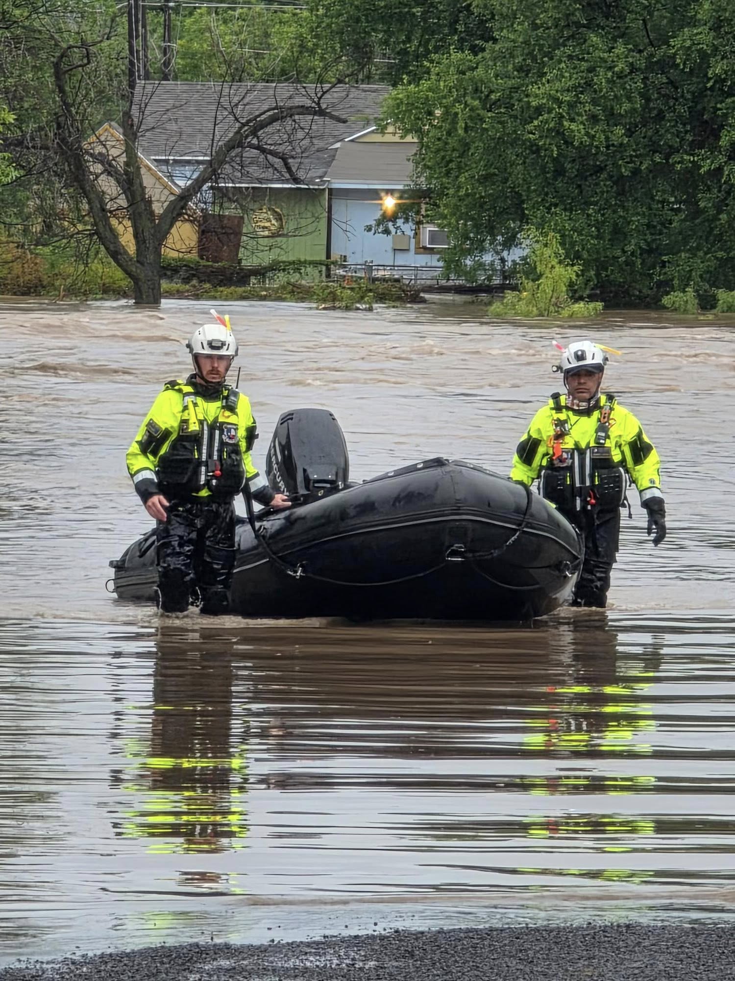
Ryan Davis (left), of Decatur, is one of 17 first responders with the Fort Worth Fire Department assisting with disaster relief efforts in the aftermath of the Central Texas floods. COURTESY | FORT WORTH FIRE DEPARTMENT
The urgency behind flood mitigation became apparent last week, with more than 100 people and dozens of children killed in the natural disaster. In Kerr County, the Guadalupe River surged 26 feet in just 45 minutes during a recent flood, Lt. Gov. Dan Patrick said Friday. That type of rapid rise in the early hours of the morning July 4 was what made this flood so deadly.
Wise County Emergency Management Coordinator Cody Powell, who is leading the project, said the technology can buy officials time, especially in fast-moving events like flash floods.

A Bridgeport resident carries a family member’s belongings after several residents evacuated homes due to flooding along Country Club Road earlier this year. BRENDAN MARCHAND | WCMESSENGER
“If a sensor is installed 12 inches below the lowest point in the road, and the sensor detects the rate of rise to be 4 inches an hour, it could indicate to us the road will be under water in less than two hours,” Powell said. “There are several variables to consider, such as if it is still actively raining. But, in theory, that is a two-hour head start on notifying the public and getting everything in place to shut the road down.”

Powell said flash flooding typically involves a rapid rise in water within six hours, and the county’s new sensors are designed to help predict flood rates by measuring both water levels and how quickly they’re rising.
The sensors are installed as low as possible along roadways. Data from them is used alongside forecasts from the National Weather Service, readings from the U.S. Geological Survey and updates from upstream water districts that manage lake levels and dam releases.
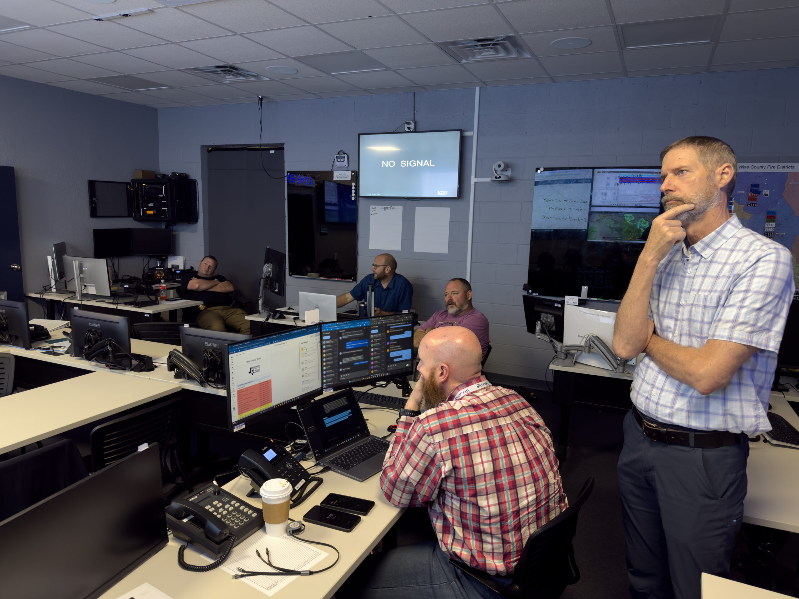
Officials monitor flood levels and lake discharge rates after the Wise County Emergency Operations Center was activated in May. The EOC provided a road closure dashboard, mapping out flooded areas and directing evacuations when necessary. AUSTIN JACKSON | WCMESSENGER
The project began with five sensors installed across Wise County’s four precincts in 2024. When heavy rainfall swept through Wise in May, the system received a major real-world test. The sensors offered live readings on water levels, giving officials a chance to evaluate both accuracy and performance of the devices.
For the most part, it was a success.
“The system performed extremely well,” Shawn said. “We plan to continue expanding this infrastructure and our goal is to work toward launching a public dashboard so residents can access real-time flood data and road closures during future events.”

Prolonged rainfall between late April and early may resulted in numerous road closures, including major thoroughfares like Farm Road 730, Farm Road 3259 and Farm Road 920, as well as several county roads. The flooding event was a real-life test of the county’s newly-installed flood monitoring sensors. AUSTIN JACKSON | WCMESSENGER
The sensors provide a ground-level camera view with still images, which can be used to confirm readings, but lose functionality at night. They can also read temperatures to help detect icy conditions on roads. But Powell said there’s still work to be done before the information can be shared publicly.
“There is a lot of fine-tuning and adjusting of the sensors and the alert parameters to do. For example, one was installed a few days before heavy rainfall and it sent us over 100 alerts the first night when the rain started. We realized the water sensor was in a bend and the water would rise and fall several inches right there,” Powell said, explaining that alerts will require verification and possibly a ‘human in the loop’ to confirm accuracy. “…We want the public informed as quickly as possible but we also don’t want to put information out that can’t be trusted.”
Of the five original sensors, one was washed away during high water. The next phase includes installing 12 more units for broader coverage across the county’s flood-prone zones. Powell said the project could easily be expanded, especially if cities are interested in participating.
The project comes amid a recent test of local resources and flood mitigation tools in May. The prolonged rains in late April and May showed how quickly water levels can change and rivers can swell in Wise County.
Just three months ago, Lake Bridgeport was at 72.2 percent capacity — after more than a year of low levels. As of July, Lake Bridgeport remains 99.7 percent full. During the prolonged rain event that helped fill the lake back up, Tarrant Regional Water District had to discharge up to 9,500 cubic feet of water per second to prevent the lake from flooding over, attempting to thread the needle to reduce the amount of flooding along the West Fork of the Trinity River.

The Lake Bridgeport dam discharged up to 9,500 cubic feet of water per second during the height of flooding in May. AUSTIN JACKSON | WCMESSENGER
That flooding event led to widespread road damage, a handful of home evacuations and a few water rescues. Still, the damage was relatively muted in comparison to what the world has watched unfold in Central Texas.
“We did deal with flooding issues and had damage on several roads, but we have seen, and are seeing, the impact flooding can have on a community,” Powell said. “Overall, we have been blessed in terms of flooding.”
While floods can’t be prevented, accurate data and advanced warning can give first responders and county and city leaders a critical edge. And that’s the hope with the network of sensors along Wise County roads.
“It’s all about saving lives,” Shawn said.
Loading Comments